
التقنية وحدها لا تضمن نتيجة في الموقع.
شريك هندسي سعودي يربط التقنية العالمية بالتنفيذ والاختبار والقبول والتشغيل داخل المشروع — فتتحوّل البيانات المتفرقة إلى رؤية واحدة موثوقة، من الموقع إلى الإدارة.
ابدأ من احتياج مشروعك أو أصلك، وسنحدّد معك الخطوة الأنسب.







تُشترى التقنية، لكنها لا تتحول دائماً إلى نتيجة في الموقع.
تقنية لا تكتمل ميدانياً، بيانات متفرقة، مخاطر تظهر متأخرة، وفجوة تنفيذ محلي.
حلول تربط واقع الموقع بقرار قابل للتنفيذ والمراجعة.
أربعة حلول بوزن متساوٍ: اعرف ما نُنفّذ، اربطه بالبيانات المعتمدة، جهّز التسليم، ثم اربط الأصول بالمراقبة. كل حل يُنفّذ مستقلاً أو ضمن مسار متكامل.
اربطه بالبيانات المعتمدة
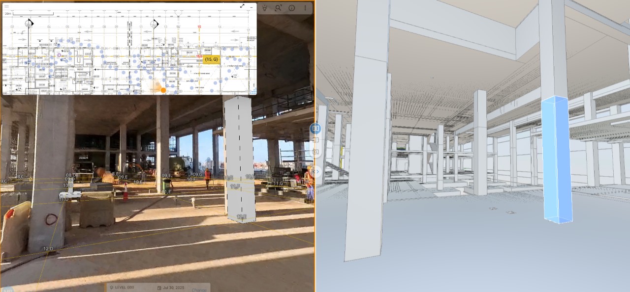
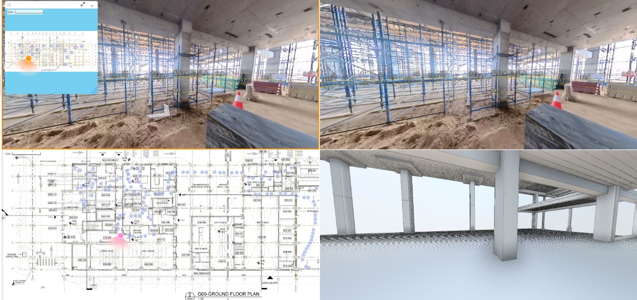
نطابق التنفيذ مع النماذج والمخططات المعتمدة، فتظهر الفجوات مبكراً.
اعرف المزيد عن الحلاربط الأصول بالمراقبة
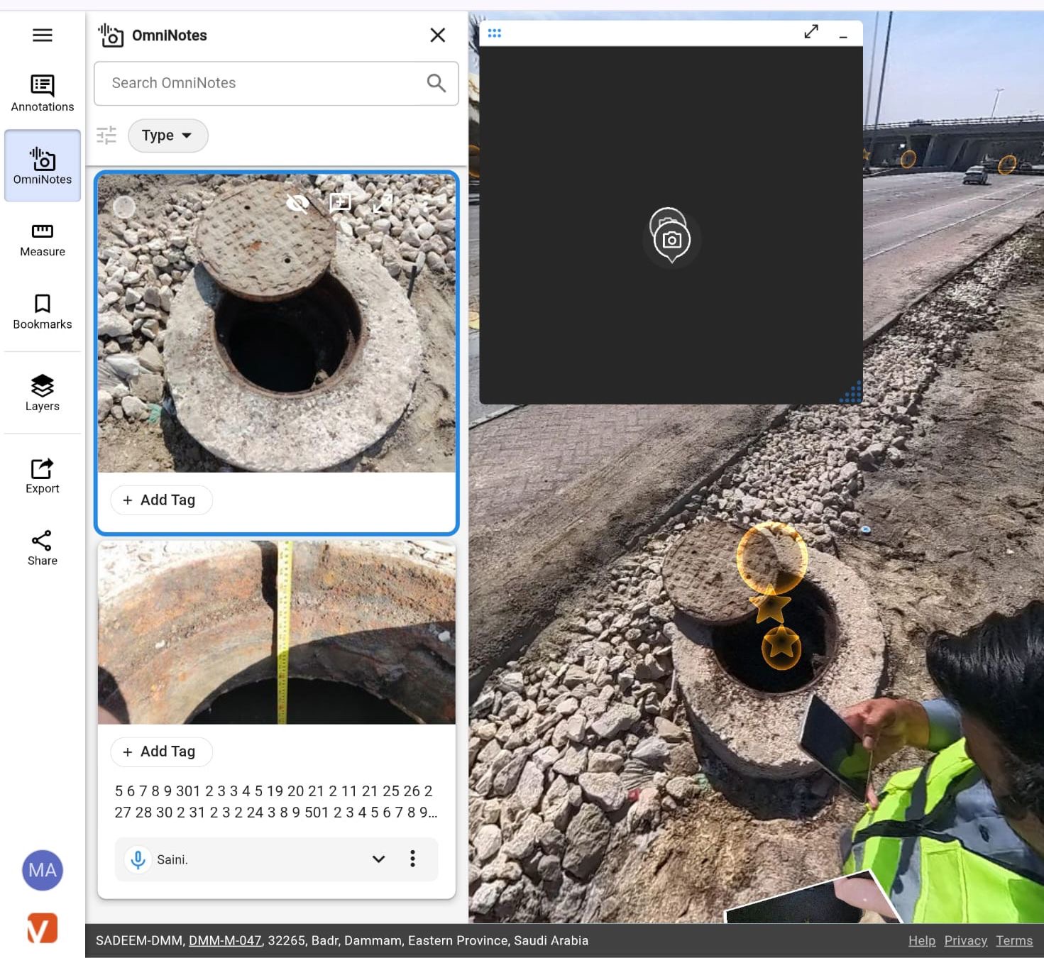
نربط بيانات الحساسات بسياق الأصل والموقع وBIM/GIS لدعم المراقبة التشغيلية المبكرة.
اعرف المزيد عن الحلمبنية على الواقع الميداني، لا على التصورات البصرية.
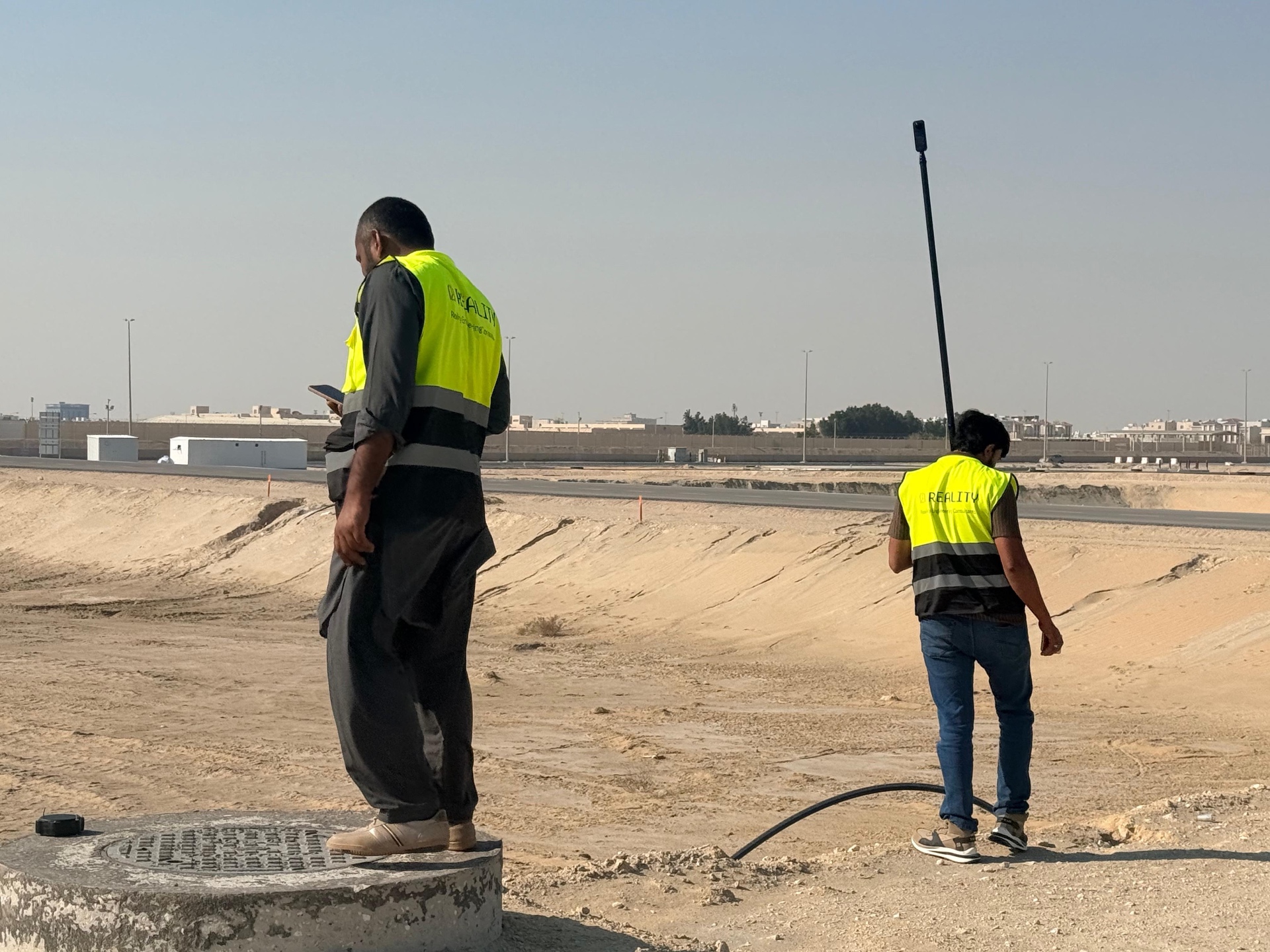
مشاريع بنية تحتية سعودية حقيقية، موثَّقة من الميدان بقياس فعلي وأعمال تنفيذ. هذا هو الأساس الذي تقوم عليه نماذج BIM وGIS والتوائم الرقمية، لا مجرد طبقة عرض فوقها.
شركة هندسية سعودية ذات خبرة ميدانية في المشاريع المعقدة
واقع شركة هندسية سعودية ذات خبرة ميدانية في المشاريع المعقدة. نحن شريك محلي يربط التقنية العالمية بالتنفيذ والقبول والتشغيل داخل السعودية، وشركة هندسية تقنية تجمع التحقق الميداني وBIM وGIS وIoT ضمن مسار واحد. نبدأ من احتياج المشروع وقيوده، ثم نحدّد الحل وننفّذه ميدانياً ونختبره ونسلّمه قابلاً للقبول والتشغيل.
خدمات هندسية وتشغيلية تبدأ من الموقع وتنتهي بقرار قابل للتنفيذ
نحوّل ما حدث فعلياً في الموقع إلى قرارات قابلة للتنفيذ والحوكمة. قرارات أوضح، تعارضات أقل، وتسليم أسرع.
أدلة من مواقع تنفيذ حقيقية
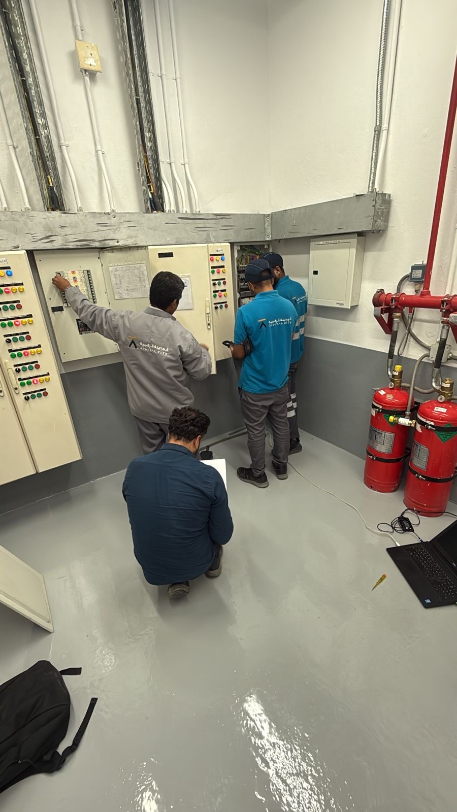
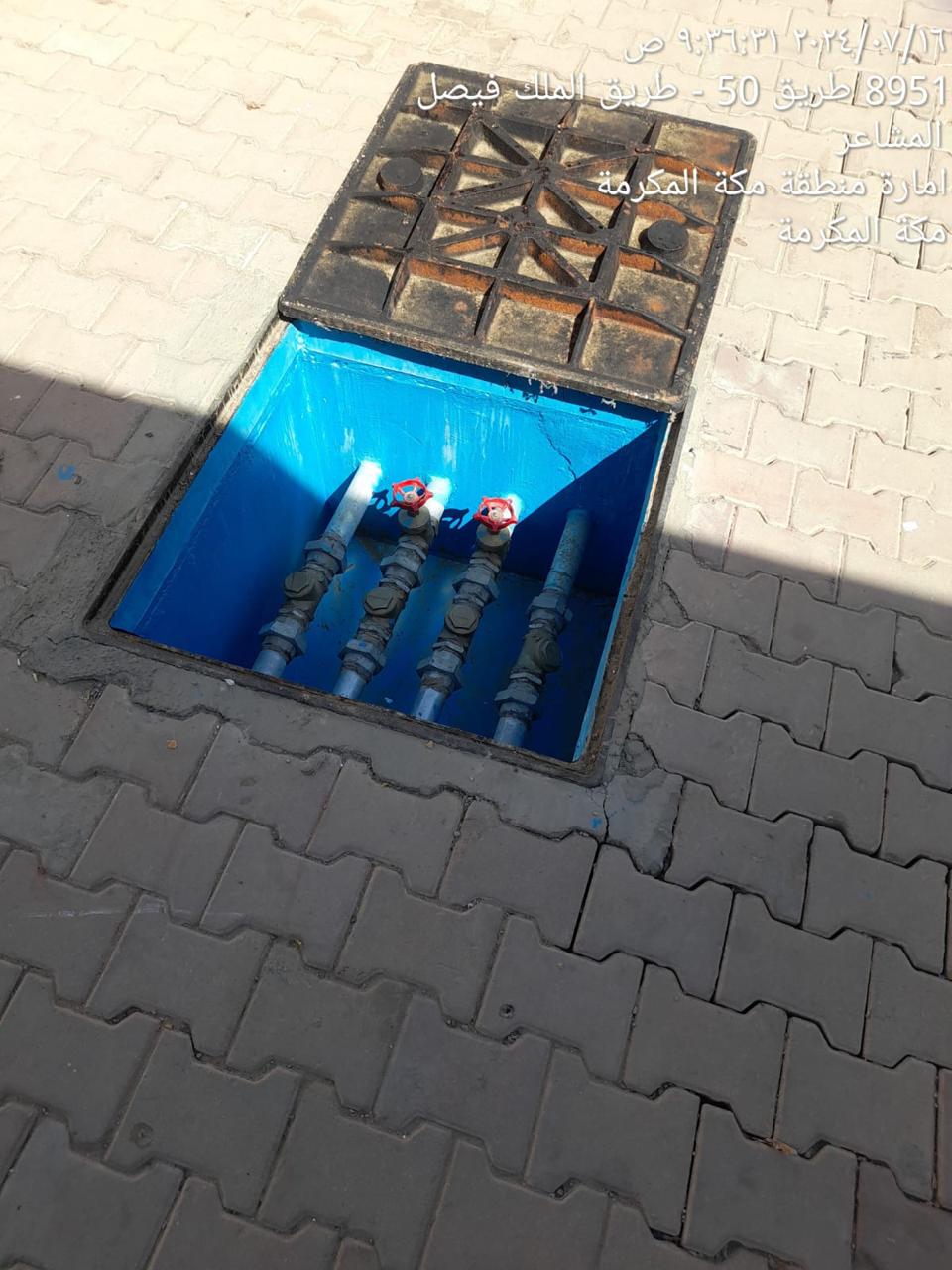
شواهد بصرية وتقنية من مشاريع فعلية في المملكة — مسوحات ميدانية، مطابقات BIM، شبكات بنية تحتية، وغرف تحكم كهروميكانيكية.
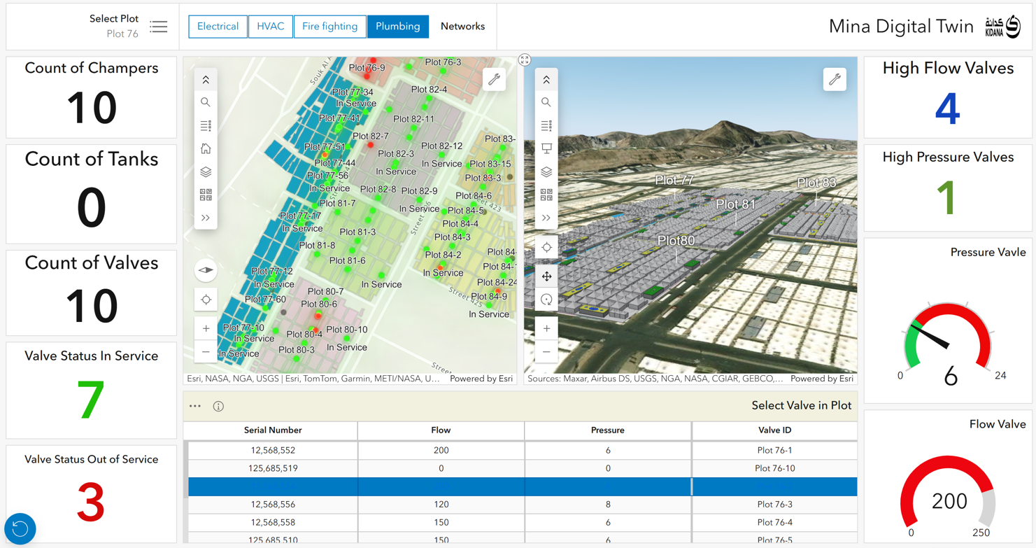
مِنى — متابعة وحوكمة بيانات أكثر من 2 مليون م²
نماذج وسجلات بمستوى LOD500، مراجع GIS، نموذج واجهة تجريبية لبيئات تشغيل شبكات المياه، وبيانات أصول منظَّمة جاهزة للتشغيل — لتوفير رؤية تشغيلية موحّدة، مراجعة هندسية عن بُعد، وحوكمة أقوى عبر أكثر من 2 مليون م².
محطات ثقة خارجية
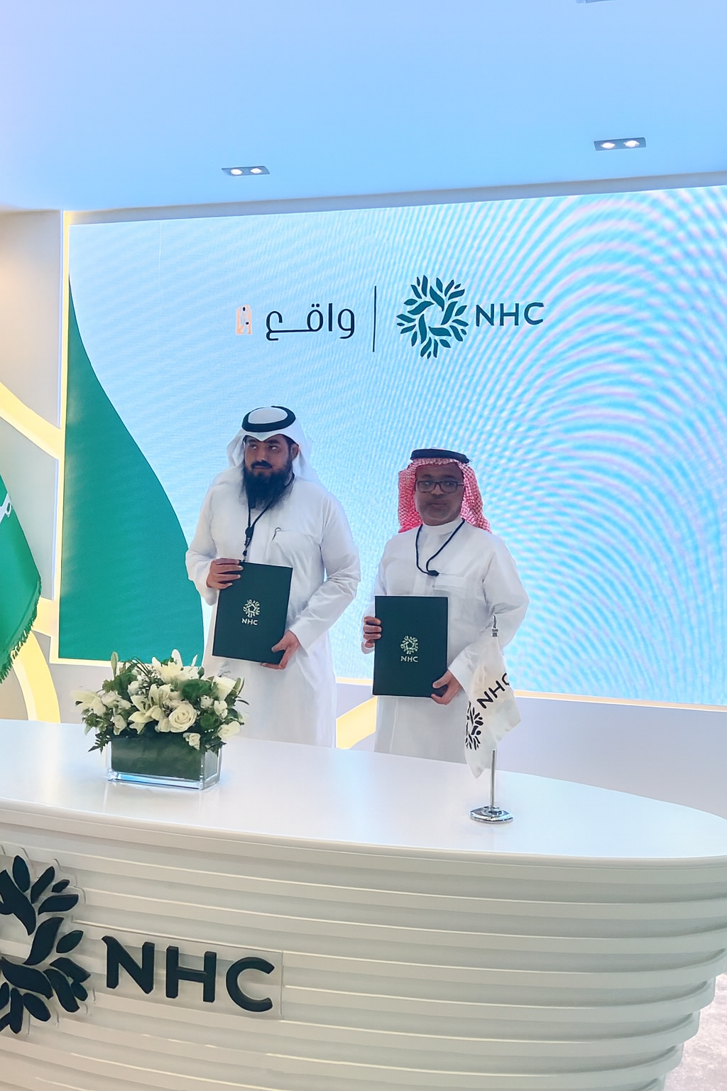
شراكة NHC × واقع في سيتي سكيب 2024
ضمن 19 شراكة استراتيجية وقّعتها NHC خلال سيتي سكيب جلوبال 2024.
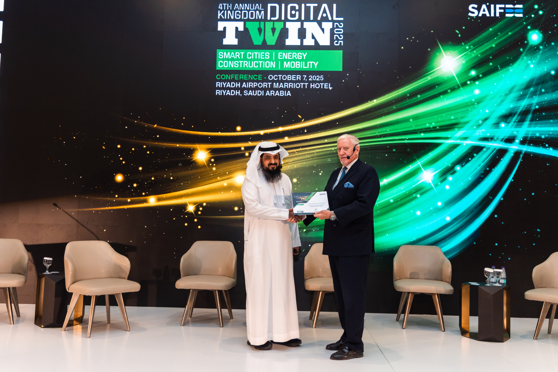
الكلمة الختامية في Kingdom Digital Twin Summit 2025
ألقى الرئيس التنفيذي م. محمد الهجرس (Mohammed Alhegres) الكلمة الختامية «Turning Ambition into Reality».
استكشف الحل المناسب لمشروعك.
ابدأ من احتياج مشروعك أو أصلك، وسنحدّد معك الخطوة الأنسب. يتواصل فريق واقع لفهم الاحتياج وتحديد الخطوة الأنسب.
ابدأ من احتياج مشروعك أو أصلك، وسنحدّد معك الخطوة الأنسب.